What We Want? An Apology? Or Action & Accountability?

Update: TAG have received a video shot inside Long Valley on the 20th of April. The gates were locked but all evidence suggests one vehicle has used the outer test track all week, and very little activity of any sort had taken place. The video is added below.

In case anyone has missed the news, there are some elections coming soon. May the 2nd sees local elections, and a general election is just around the corner.

And in case anyone has missed it, DIO civil servants [sic] have been unable or unwilling to follow a direct instruction from an elected politician and Minister of State.

So it could be a good time to focus the minds of whoever might like to be our next councillor or MP perhaps? By asking those who seek to represent us a few probing questions about how casual recreational access to the military lands can be enhanced, and how DIO can be held to account for their behaviour, we can cast our votes wisely and endorse those who support enhanced recreational access.

One thing TAG won’t do is endorse a politician or party. Preserving and enhancing recreational access to all the military lands when not in use for training should and will remain strictly apolitical as far as TAG is concerned. The benefits to the local community for mental and physical well-being and health are both broad and deep and everyone should be embracing and supporting access.

But TAG will raise concerns and issues when our local politicians and Ministers are not applying accountability. And in this regard we find we are not alone.

Horizon Scandal

The issues, deceit and downright lies being exposed by the Post Office scandal, and the utter pain and suffering inflicted on sub-postmasters is abhorrent. Any decent democracy should, rightly, outraged.

Without in any way pre-judging the outcome of the inquiry, there is a repeating theme; a persistent and consistent failure by Ministers to question or challenge what civil servants told them. Its telling it took a TV drama to pull the issue into sharp political focus.

“I’m sorry I did not see through the Post Office’s lies”

Ed Davy – Minister responsible for the Post Office 2010~2012

Whilst welcomed, sorry will count for nothing if you went to prison, were hounded out of your community, or declared bankrupt, will it?

Paula Vennels, former CEO of the Post Office is somewhat belatedly being investigated for misleading Parliament over the failings of Horizon. Well, yes…very good…but TAG asks why does it take a TV drama to trigger politicians to challenge civil servants?

Why indeed?

In the past we might have laughed at the script of BBC Yes Minister series as the civil servants ran rings around their political bosses. Watching the series now leaves a dirty taste in one’s mouth as it reflects more like a documentary of how failure by weak and ineffective politicians has lead us directly to the Horizon scandal and a very real issue of zero accountability. The lack of trust and accountability persists and the rot stinks. Yet here we are, being treated with contempt by DIO. The comedy is gone and any politician who thinks it’s acceptable or funny is part of the problem, not a solution.

The inquiry has heard evidence from then Post Office CEO Alan Cook, who claims he didn’t know what was going on. The man who was in charge of the Post Office at the height of this scandal was unaware his own organisation had the power of prosecution. TAG will not prejudge the inquiry findings…but this evidence…is challenging. And TAG have already seen collective and individual DIO staff memory failure trumping written evidence.

Trust in leadership and the civil service is being undermined by such admissions and claims. It gets really hammered when folks like former CEO David Smith record “Brilliant news. Well done,” when hearing the news a pregnant sub-postmistress went to jail. At the inquiry Mr Smith went on to issue an apology, but this was not accepted.

The impact on the sub-postmasters has all the hallmarks of criminal behaviour. TAG applauds and respects their tenacity and dogged pursuit of the truth. And “sorry” won’t bring back their losses, on so many levels.

Accountability and DIO

On a different scale, we have DIO civil servants [sic] running around doing their own thing. Ministerial direction to keep Long Valley open has been ignored at will and DIO chose to delete the evidence recording minimal use.

Surrey residents are treated to a board carrying far more information. Contrast this to the message delivered to the community using the Aldershot Lands.

The lack of accountability goes beyond locked gates and into the areas of powers arrest and loss of liberty, refusing to apply the law of the land and treating FOI requests with contempt and logging false incident reports that suit their narrative.

In due course the issue of TSMs and powers of arrest will receive its own detailed blog. So will matters around false incident logging. The matter of arrest is serious; the Serious and Organised Crime Act of 2005 revoked powers of arrest by authorised persons, yet in 2020 a TSM made it clear “I can arrest you” because thinking that legal insight of “I have read the byelaws” was good enough.

The Surrey message is “Enjoy the lands responsibly”. The Aldershot message is “Go away and don’t come back” and this DANGER sign at Long Valley has been proved to tell lies far more than the truth.

Some of the worst “evidence” presented by DIO came out when Ash Ranges was closed. Photos purporting to show vandalism and justify fencing recorded damage miles away from the excluded area. DIO even helped themselves to a local’s photos that “proved” damage, breaching copyright and once again ignoring the law of the land.

TAG and the Ash Ranges campaign group Save Our Spaces started to compile a list of DIO false or deliberately misleading statements and you can download it here:

It does not make good reading when you take into account civil servants are duty bound by the Seven Principles of Public Life.

What is not clear is the root cause of this behaviour. Is it malicious? Do DIO simply hate civvies and casual access? Or is it just pure and simple incompetence? With the arbitrary locking of gates at Long Valley and Porridge Pots, in support of civilian events or when empty, it could be as simple as being spiteful? TAG are not qualified to assess this in fine detail, but a PhD is waiting for someone and there is a gap in knowledge needing to be filled here.

The British Journal of Sociology have recognised a weakness in the study of incompetence and the recent paper highlights the gaps in our understanding. The FT agrees and thinks a closer look at the issues of incompetence is overdue. If asked TAG would be more than willing to suggest a case study or two from what can only be described as a target-rich environment.

Like the Post Office, left alone DIO can and will carry on unchecked and accountability from the politicians is, based on how Long Valley remains locked and unused, notable by its complete absence.

A sign at Porridge Pots. Message is not based on law or what the politicians say. Nothing stops DIO pushing misinformation.

You might think local politicians realise the community cares, but TAG do wonder if the message has really got through?

Even after publication of the 2020 survey its a struggle to get politicians to accept people care about recreational access:

Clearly 11,000 respondents and over 8,000 personal statements do not count for much. If you responded then TAG are grateful, but we fear your voice has been and remains completely ignored while the politicians remain tuned into DIO civil servants [sic].

Why It Matters

The truth matters. It’s a simple as that. But the issues go much deeper.

When an organisation or body loses its credibility and trust, a void forms. Something or someone will step in and fill it, and this some very negative outcomes. Every time a civil servant tells a lie or suppresses the truth, and they doesn’t face accountability they think they have got away with it.

But as the Horizon scandal shows, the truth can and will leak out, or be uncovered. Authority and trust are fragile and once damaged takes years to recover.

20th April 2024. Gates locked and all the evidence points to no military training and just one vehicle using the outer test track all week. This does not meet the Ministerial directive to keep the area open.

“Truth will ultimately prevail where there is pains to bring it to light.”

George Washington

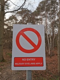
Even when DIO civil servants [sic] are prepared to spend upwards of a half million quid in an advertising campaign trying to convince us that all the Aldershot lands are ranges. In the case of Long Valley and much of the dry training areas, its not a range and the DANGER signs were abused from the very first day of use, covering a commercial civilian event while pushing a message of military training.

Open lies like this simply demonstrate how egregious DIO attitude and approach to the local community has become. Do civil servants [sic] really think we are that stupid?

Bottom line; a post-event sorry for loss of casual recreational use of the lands will not restore the lost access. DIO need to be held accountable now.

What Can You Do?

Like we said, TAG will not endorse a politician or party. And we recognise we are a long way from the scale of the Horizon scandal. Yet just like the Post Office staff DIO are pulling the wool over politicians eyes and remain unaccountable. We can learn a sound lesson from the Post Office method of mistake and arrogance management and make sure DIO stop and change.

TAG suggests everyone asks if their representatives are delivering accountability and outcomes that benefit the community:

  • How could DIO be allowed to fence off Ash Ranges when the evidence to close them was so weak?
  • Why can a Minister issue a direction to keep Long Valley open, and DIO simply ignore it?
  • Why are DIO deleting the best available evidence of booking on and off records?
  • Where are the additional gates at Long Valley and why have DIO not installed them?
  • Why are the gates at Porridge Pots (G2) locked and the space empty?
  • How much money has been wasted on unnecessary fencing?
  • How much time and money do DIO spend on refusing legitimate FOI requests?
  • Why are DIO permitted to ignore the Seven Principles of Public Life?
  • Why did DIO remove many of the car parks and block access?
  • What are YOU (MP) going to do about DIO?
  • How can we objectively measure any claims of success in managing DIO accountability?
  • Why does this government find holding civil servants, and specifically those employed at DIO, to account so difficult?

Should any politician suggest they have been working hard on the issue just ask this:

How can we objectively measure the outcome of your claims of success in holding DIO to account or making a difference and preserving casual recreational access?

As ever, the easiest way to communicate to your MP is via the Write to Them website.

Because only positive change and outcomes, such as the extra gates at Long Valley and DIO meeting the Ministerial instruction to keep it open, really matter. Everything else is just noise. So far, on both points, nothing has changed and DIO have been left unchecked to carry on regardless. This cannot be described as a positive outcome.

Remember, the option to do nothing is always a choice.

But DIO thrive on apathy and are emboldened by a disengaged community. Left to their own devices all the mood music points towards to increasing hostility from DIO towards the locals and casual recreational access.

The same is true for politicians. If the subject of DIO, their behaviour, the lack of evidence based policy and irrational restrictions on casual recreational access are not raised, nothing will change.

Do nothing and we can expect more restrictive and irrational policies from DIO.

So what is the lesson from the Post Office scandal? What can politicians and the community learn from it?

It’s really simple;

  • Do not automatically assume DIO are telling the truth.
  • Do not assume DIO are following accepted and recognised standards.
  • Do not assume DIO are applying evidence to shape policy.
  • Do not assume DIO are acting in anything but their own self-interest.
  • Seek evidence.
  • Examine DIO claims and assertions in detail.
  • Seek the truth.
  • Question everything.

“It is always the best policy to speak the truth, unless, of course, you are an exceptionally good liar.”

Jerome K. Jerome

Demand and expect evidence. Seek the truth. Expect and require a duty of candour. Expect DIO staff to fulfil their contractual obligations and uphold the Seven Principles of Public Life. Remind them there are no exclusions or opt-out clauses.

Then it’s just possible we will avoid hearing another political or civil service [sic] apology for a failure to diligently apply accountability in the future.

DIO Public Safety Announcement; Single Track Is Dangerous (Spoiler Alert: No It Isn’t)

3rd April 2024 – Update. TAG have gathered more evidence to demonstrate how DIO’s ideas around safety are misplaced. Section added below.

Whenever we hear DIO pass comment on matters related to MTB and cycling, it’s difficult to see a connection between the abstract ideas, and the reality. The basic theory is fine but the nuanced detail and most importantly, hard facts and real insight, are absent.

If you are a regular reader of the TAG blogs and don’t need to watch a series of videos picking DIO’s “policy” apart, feel free to scroll to the end and write to your MP asking them to start pressing the case for DIO to stop treating cyclists with contempt, recognise the reality of how we use the lands and to treat cyclists with respect.

If not, do please read on.

Faced with new byelaws* DIO will need to be seen to do something to accommodate cyclists. So far the mood music TAG has picked up on suggests cycling on some fire/vehicle roads will be permitted, but the single track we use and love will be strictly off-limits.

How a legal definition is going to read and be interpreted will be very interesting. But it will be even more entertaining to sit back and watch DIO actually try enforce the unenforceable.

The experience driving around the fire roads in a pickup cannot be considered the same as riding a bike along the 400 miles or so of informal routes.

Why is single track off limits? Apparently it’s not suitable because the speeds cyclists can reach are dangerous.

Yes, according to DIO single track is inherently more dangerous than a fire road so we must never use them for the safety of all. Even if no one else is there.

There are risks and costs to action. But they are far less than the long range risks of comfortable inaction.

John. F. Kennedy

TAG have a few observations on this mindset.

Firstly, we must suspend the reality of vehicles are using the fire roads because, obviously, there is some magic force field that prevents cyclists ever coming close to one.

TAG would like to see the risk assessment for this one. How do cyclists and vehicles avoid each other if they are compelled to share the space? The evidence base to support this policy would be appreciated as well.

Then we must also forget that sometimes single track goes uphill.

Some of if doesn’t and gravity is a great asset, but DIO are ignoring the simple laws of physics here. Some objective evidence would be required (Civil Service contract of employment and Standards in Public Life) for us to be convinced, but TAG concludes the evidence won’t exist. Or DIO have deleted it for “business purposes”.

If DIO can ignore ministers, then ignoring the laws of physics is simple. Hands up who can cycle uphill at 20mph? Anyone?

Next we must ignore the flat bits. With the heart rate running close to 180bpm a pace close to 10 mph is a good effort on a dry day. Just check the Strava stats of a few of the single track segments. Then try sustaining that level for a full ride. Anyone who can hold that pace should be in the olympics or racing professionally and at this point we are deep into edge cases. Most mere mortals want a nice day out and that includes a bit of single track.

And last but not least we need to suspend reality and forget there are fire roads that end in a dead end with tracks leading off in all directions. Or terminate in a locked gate.

None of it makes any sense or reason, but just as the locking of gates on a vacant Long Valley has taught TAG…never, ever expect logic or good reason to apply when DIO set their hearts on achieving a bonkers agenda.

He who is not courageous enough to take risks will accomplish nothing in life.

Muhammad Ali

If DIO would like to get in touch and share evidence, then please use info@trailactiongroup.co.uk to drop us a line.

It’s also galling to watch other user groups, typically organised events, runners, orienteering groups or the Pony Club, seeing no such restrictions. The drag hunt didn’t stick to the fire roads…why should we?

Hypocrisy? Double standards? Bias and prejudice? TAG certainly think so. But before we seek some help with accountability, lets have a look at some evidence.

A Beginners Guide to Single Track Use

As part of our service and in spirit (if not in practice) of postive collaboration and cooperation, we have pulled together some short explainer videos. These will give DIO staff a deeper insight into how MTB use the lands, and what measured speeds we can actually achieve when using single track.

Is this data perfect? No, not at all. But its a lot better than nothing, or basing policy on thoughts and feelings.

But first we need to highlight a DIO spoiler alert; MTB is not as fast as you want to think it is.

First up, a short video on what DIO may think is acceptable and safe to use a bicycle:

Just like sticking to the fire roads, watching a video is dull as dishwater and unnecessary. So we won’t be wasting too much time and keep the video short. Just enought to bore the viewer into getting why fire roads are not where the pleasure really is.

Next up, some single track with a spot of downhill:

We are not saying speeds can peak, but to set policy that all single track is dangerous when only part may (stress may) carry higher risk is neither rational or reasonable.

Nevertheless, that video is likely to give DIO kittens.

It’s got tree roots. And off camber slopes. And it’s downhill. Some sections have a rooty, camber and slope combo. Its loaded with more perceived risk than Russian roulette with 5 live chambers…but feel free to fast forward to the end and see every MTB rider arrive alive and well at the next fire road.

Next up we have a little track that runs downhill, but again the speeds are kept low by the nature of the trail and terrain. It twists and carries natural features that slow riders:

Check the speed. It’s all single track and some downhill but there is a good line of sight.

Plenty of natural, twisting track here to keep a downhill speed low.

Risks where speeds can be higher can be mitigated by design. But this would need a) DIO to accept cycling was welcomed and b) cooperation with folks like TAG who understand more about than MTB that someone who drives around the lands in a pickup or sits behind a desk. This should be something your MP can help with and by writing to them (read on) it helps press for DIO to change.

Now we have a section of single track/multi-use in a part of the Aldershot lands where military training is not permitted thanks to the rules in the Aldershot Standing Orders:

Section of multi use track that DIO maintain is not safe for cyclists. Even if it’s flat and no troops present. TAG have given up hoping DIO will apply logic to anything.

And here we have the classic dilemma DIO are unlikely to be able to reason away and another example of where DIO logic meets reality. And the “logic” falls over. The fire road ends and three single track routes carry on:

Are DIO really expecting us to just turn around because the fire road ends? When decades of use has established the trails? Honestly?

Here’s another great example. The fire road runs into a locked gate:

These gates block a long-standing access point. Local MP Ranil Jayawardena reassured residents some new gates were coming to Long Valley 3 years ago, but DIO have yet to deliver.

This section of single track is in Long Valley. It’s an undulating, twisting route and speeds are hardly peaking. The finish is uphill and it’s a short and steep one. Check out the heart rate at the end to see the effort expended:

The rider is 56 years old and has maintained fitness over the decades by riding on the lands. A heart rate peak of 193bpm is high for some but normal in this instance.

The best kind of single track is one that demands 100% concentration. Thinking about the ride and nothing else becomes so immersive the worries carried onto the lands slip away as both mind and body are exercised, reset and refreshed. The rider, whose heart rate peaked at 193bpm is 56 and remains fit thanks in part to these lands and trails.

The ethos and heart of the matter for MTB is living in the now and engaging mind, body and spirit with the ride and what is going on. In military speak it’s called situation awareness and this moment is not available to anyone stuck inside a pickup cab.

“I am always doing that which I cannot do, in order that I may learn how to do it.”

Pablo Picasso

This is why we ride single track. It goes to the core of what it is to be a cyclist and a mountain biker. DIO must realise and accept the fire roads are just not going to cut it.

If anyone knows of other completely bonkers examples of where fire roads terminate and leave the cyclists with nowhere to go, do please send us a location. Or better still, video it!

No prizes for the best example, but a really warm glow is assured knowing you are holding DIO to account for their policy and actions.

Updated section

TAG have found a place where MTB can pick up the kind of speeds DIO find troubling. Just ride any downhill fire road and watch the pace climb as gravity takes over. Fire roads are where vehicles must be used. The Aldershot Standing Orders (Page 13, 37.d) says so and this narrow space is what DIO expect cyclists to share “for safety”.

Here’s a run down from the top of Caesars Camp:

DIO worry about speed. Yet the fire roads are where MTB can really pick up and maintain pace. TAG have given up expecting rational, evidence lead policy from DIO…picking apart their daft and emotive thinking is straightforward.

In all cases evidence must be used to set policy. The videos TAG produce count. So does the GPS data everyone gathers. Strava Heatmaps…open source or paid for detail…they are all robust evidence that informs what really goes on. We fully expect DIO to engage and seek to understand exactly what the real issues are, and we will listen to any valid and evidence-based concerns. We will alway seek cooperation and if necessary compromise.

But remember, as taxpayers we are paying for this “service” and TAG firmly believe DIO can and must go a lot further to make sure the local community receives value for every penny.

Some of the videos were shot in Long Valley on the single track (blue dashed line) and has avoided the DIO made up tracks (brown dashed) and uses just a little of the test track routes (not shown for clarity). A GPX file of the blue route is available.

If any MTB rider wants to live right on the edge and check out the dangerous single track in Long Valley that featured in some of these videos, we have a GPX file that will guide. WordPress does not like us uploading these file types so just drop us an email to info@trailactiongroup.co.uk and we will send a copy.

Cyclists To Blame

TAG are firmly of the view that any permissive routes will be respected as much as Section 4.2 no cycling ban of the current byelaws. There is plenty of evidence to suggest cyclists have ignored the laws since 1976 when they first came out, and there is no indication this will change.

The outcome will continue to see recreational cyclists ignoring what amy daft law drafted out outlaw single track says, and what DIO think is a good idea. Its all unworkable.

Thus DIO will continue to blame (in their opinion) irresponsible cyclists for ignoring the laws, continue to treat the cycling section of society with a mix of prejudice, distain, contempt and arrogance. DIO will continue to use to blame MTB to excuse more fences and locked gates.

The mountain bikers are irresponsible and dangerous, and refuse to follow the law…so we have to block access for all. Mountain bikers will be a handy scapegoat.

It’s all our fault. Even if it isn’t.

But that will suit DIO’s broad agenda and hostility towards all recreational users. Except of course those who pay (carrying a firearm, riding a horse, killing animals, drag hunts, commercial dog walkers…the right sort) or those considered favourable (Ramblers, equestrians) even if their numbers are dwarfed by cyclists.

Never let the facts get in the way of egocentric policy. Based on current behaviour this is likely to be DIO’s reasoning and justification.

What Can You Do?

The truth is more likely DIO are unable or unwilling to accept casual access of any kind, but are unlikely to go up against the walkers or Ramblers. The former are vocal and numerous, and the latter legally prepared and have challenged DIO in the past. Instead they focus on what they think they can control and target what they see is a minority, even when there is zero evidence to suggest they actually need to do anything.

Waste of taxpayer money? TAG certainly believe so.

Any and all letters to the local MPs help raise and maintain the profile of how important recreational use is.

Write to your MP, asking that DIO be compelled to use a firm evidence base to set policy, and that cyclists be given equal status as what those on foot enjoy today. Remind MPs that DIO are ignoring ministers and ask why this is permissible and what do they intend to do about it?

Anything less will see DIO remain openly hostile to a section of society. 4200 people identified as cyclists in the byelaws recreational survey, so it’s hardly a minority view or an edge case pleading here is it?

If you would like to read or remind yourself of the survey, here’s the NE Hants constituency copy:

In this election year remind your MP your vote counts. If it’s true, tell them the lack of support for recreational access to the lands will lose your vote.

The easy way is to use the ever-helpful Write to Them website.

*Latest update on the byelaws. They are due to be published as a stream of radiation pulsing from the heart of our sun after it has consumed its fuel and collapsed under its own weight. Thats in roughly 6.4 billions years from now…but DIO are likely to consider this timeline achievable.

Did You Know – Where Are They Hiding?

One of the key points TAG’s code of conduct is giving space for soldiers to train.

The recent Respect The Range campaign managed to raise an awareness that our military lands are working environments that support the activities of our defence forces, however it did very little to educate. The campaign encouraged irrational and baseless fear but offered zero practical advice. It was interesting to find the imagery in the campaign contradicted the Aldershot Standing Orders:

When the training undertaken does not appear to present a risk to civilians, or where a unit can accept civilians walking or riding horses on the area being used for training, then it is HQ SE Trg Estates policy not to exclude those civilians. 

Aldershot Training Area Standing Orders – 10. CIVILIAN ACCESS TO MOD TRAINING LAND

However, it remains the responsibility of all of us – dog walkers, joggers, cyclists, picnic organisers and equestrians – to let soldiers get on with the business of training without interruption.

The first and perhaps most important step we can all take is be aware of what is going on. It’s not always easy but even with the best camouflage there are signs soldiers are out and about.

Continue reading

MTB And Erosion – How Much?

Back in February TAG started a long term project to measure exactly how much erosion was being caused by mountain biking on the military lands.

With over 400 miles of tracks and trails we can’t do it all. But we did choose two trails on Beacon Hill for a closer look.

Surveying this kind of terrain is done using a Leica GS07 NetRover (expensive…accurate…) and a DJI drone. The Leica precisely measures a series of points on the terrain and the drone shoots several hundred images. A technique called photogrammetry then merges the two to produce an accurate 3D representation of the surface.

The drone flew back in January to shoot the first set of images. It might be cold but waiting for vegetation to die back helps. Photogrammetry can struggle with the green stuff plus the bracken hides the trail surface and thats the bit we are really interested in.

The drone flew for a second time this week and the images processed.

Continue reading

Did You Know – Doing It Right?

TAG wish to see a better informed and engaged community using the lands. We recognise the massive value and benefits to physical and mental health it brings. Our community is a nicer place to live because of the access we enjoy and its our responsibility to treat the training areas with respect and the TAG code of conduct is aimed squarely at that outcome.

“The campaign was called ‘Respect the Range’ and was framed around reciprocation [TAG emphasis] of respect between the army and the public, acknowledging each’s need and desire to use the land.”

Respect The Range Requirements – Background to your Requirement 1.8

The Respect The Range campaign had good intentions but the messaging was far too simplistic. Specifically, for the Aldershot areas the shared content was off-message.

Continue reading

Did You Know – The Tale Of The VD Prison?

Lurking on the lands near Aldershot is a slice of history that has been largely – if not completely – forgotten. And its a history that tells a multitude of stories, covering social attitudes and Victorian beliefs that today are – to be quite frank – almost unbelievable.

The existence of now lost cluster of buildings at Ceasars Camp is revealed on the 1888~1913 Ordnance Survey 6-Inch maps of the area and referred to as a Lock Hospital.

This threw up quite a few questions; What on earth was a Lock Hospital? Why was one located at Aldershot? When was it built and why did it fall out of use and disappear?

Lock Hospital location – What3Words

There were a few surprises on the journey of discovery.

It was a bit of a shocker to find out the Lock Hospitals were venereal disease (VD) prisons enabled by an Act of Parliament, and every inmate detained was exclusively a woman. The reasons for their founding are, on reflection, less of a surprise. VD was rife within the Victorian British Army and the Aldershot Garrison but the statistics of the day detailing infection rates were eye-watering. The methods used to control the disease were poorly conceived group-think echo chamber based promoting discrimination and prejudice enforced by the wrong arm of the law.

So how did it all begin?

Contagious Diseases

Following the acquisition of lands in 1854 the Aldershot garrison expanded. But there was a problem in the form of venereal disease infecting up to 40% of those who served and by 1859 the medical journal The Lancet was calling for control over prostitution and the establishment of special hospitals to treat prostitutes.

Aldershot Lock Hospital Plans
An amazing piece of history recording the hospital in ink on waxed linen. Detailed site plan for the Lock Hospital at Aldershot. Image source; National Archives.

Three Acts of Parliament followed that permitted routine examination and any woman (yes you read that right, just women) found to be diseased would be forced into a Lock Hospital for treatment until they were cured.

Why just detention for women?

It takes two to tango and share a sexually transmissible disease but the belief at the time held true the “fact” that venereal disease could only be passed from a woman to a man. Apparently chaps could catch it but not pass it on. In a Parliament made up of exclusively white males, blaming someone else for what is a joint enterprise was not going to be challenged, or if it was the majority were not about to agree. The military doctors were onboard with this message too, claiming regular inspections of nether regions “would destroy the men’s self respect”.

Any woman refusing treatment would be imprisoned and any brothel keeper knowingly sheltering an infected prostitute fined £10. The Aldershot Lock Hospital was constructed solely for the purpose of controlling VD that was running rampant in the army.

Morally Disgusting and Unworkable

The general health of the army had been exposed as poor and it took the crisis of the Crimea war to really raise the public profile. Public outrage at military and ministerial incompetence (some things never change) in running a war sought changes, which in the end saved the soldiers from the suffering inflicted by their employer.

Florence Nightingale, who had witnessed the squalor and filthy environment first hand in hospitals, had helped expose the simple fact that soldiers died at double the rate of the average civilian male. The War Office was negligent.

But on the subject of forced examination and controlling VD with a regime aimed at solely at imprisoning women Florence was blunt:

“Morally disgusting, unworkable in practice, and unsuccessful in results”

Florence Nightingale, Lancet – 1863

But the issue could not be resolved by male virtue alone and providing alternative entertainment facilities for soldiers did nothing to check the spread of disease. In 1861 an estimated 33,000 from a total of 91,000 soldiers stationed in the UK were admitted to hospital for venereal disease treatment. Monotony of barracks life was enough to “drive men to intemperance and debauchery”.

Thus the Contagious Disease Control Act of 1864 was born. Ill conceived legislation rarely works and this one failed to deliver its aims when hospitals refused to cooperate and civilian doctors complained at the miserly rate of pay for examinations.

Building plans for the Lock Hospital at Aldershot. Image source; National Archives.

In 1866 the Act For The Better Prevention of Contagious Diseases (no we are not making this up) was passed and amended the 1864 Act, beefing it up adding powers that could see any prostitute within 5 mile radius of garrison towns detained by a constable and marched off for medical examination, and certified hospitals would offer moral and religious instruction.

The plans for the Aldershot Lock Hospital are dated 1871 and the 1881 census recorded 38 female occupiers, or most likely detained prisoners. The hospital was a busy place with the the medical officer in charge reporting 1,494 examinations over a 77 day period in 1871, of which 138 women detained. Liberty was refused until cured, or in the case of syphilis the 9 months legal detention period was up.

Repeal And Change

Eventually the Acts were – quite rightly – recognised as deeply objectionable and repealed in the CD Acts of 1886. Prostitution didn’t end in 1886 but the morally repugnant and dreadfully sexist chunk of Victorian legislation was condemned. The need to treat venereal disease remained and in the 1891 census with the Aldershot Lock Hospital recording 15 female patients with their occupations listed as anything but prostitutes. Forced detention was no longer permitted.

The plans were amended and corrected in 1888 and the buildings used as a store before later being condemned. The main site plans are marked demolished 17/11/22.

At the site of the Lock Hospital very little remains. A few courses of brick and some footings are visible

Today society has thankfully moved on. VD is still circulating but penicillin has revolutionised treatment with both responsibility, education and treatment aimed fairly and squarely at both sexes.

To visit the site today reveals very little evidence of what was but visible in the ground are brick footings and a few sections of wall that hint at what was.

Irrespective of what remains the history of the lands remains important. The cultural and social ties to the lands are strong – although we would agree few would see a VD prison as the most palatable subject. Nevertheless, as an archaeological site the area remains an example of mid-to-late Victorian attempts at social healthcare and disease control. Preservation of what lie below the surface is unknown but may turn into a treasure trove of deeper insight.

The objection to poorly drafted legislation and misguided belief to used to control a social disease is on a massively different scale to any Byelaws review. Any attempt at comparisons between historic laws to control VD and military byelaws gets short shrift for its impossible to draw parallels between the impact on the lives of anyone held in a prison for the bad luck of catching a dose of the clap versus recreational access.

But there is another comparison we can all draw an experience from. From March 2020 lockdowns lead to state-enforced confinement with the single purpose of containing a contagious disease. All of us, to a greater or lesser degree, will be carrying the memory and experiences of what it was like to see liberty and freedoms removed for greater public health.

Sound familiar?

Demolished in 1922 the site today carries very few reminders of the Lock Hospital

Pride and Prejudice

History demonstrates how opinions and attitudes change. Discriminatory, misguided and prejudiced legislation can be removed from the statute books if enough voices call foul, refuse to accept the normalisation of locked gates and empty spaces and choose – if necessary – to take a path of open dissent and non-cooperation.

The best bit? The local community need not wait for an Act of Parliament.

The current Aldershpot byelaws can be (and have) amended for certain groups with illegality removed with the stroke of the pen.

Its right there in Section 8(3) of the byelaws.

The potential for positive delivery against the Social Value Act is immense. One of the metrics (MAC 1.4) directly measures the benefits of any public tender spend against the simple objective of improving the mental health outcomes of those affected by COVID-19 confinement and its aimed at supporting businesses and communities alike.

And those impacted by COVID confinement are right here, in the local community. There is a very good chance mental health is being improved right now just by someone walking, jogging or riding a bicycle on the lands.

“It is difficult to get a man to understand something, when his salary depends upon his not understanding it.”

American writer Upton Sinclair

Currently the agreement between DIO and TAG – the one which is recorded in writing but not accepted as tangible – remains the best we can secure. Meanwhile the attempted ban on cycling implemented in the 1976 byelaws has persisted. This now makes every ride a protest at a law that remains an archaic and out of touch nonsense that serves no one.

Individually the protest is an insignificant expression against what is going wrong.

Collectively the Strava heat maps reveal a massive, persistent and ongoing act of civil disobedience.

It’s right there, hiding in plain sight. Personal and collective protest at arrogance, denial and misguided prejudice.

With government policy directly supporting and investing money into cycling and encouraging more to ride it really looks like the vast majority of MPs should be backing cycling. Yet none in the civil service or political classes are able to grasp the simple fact horse riding just isn’t where recreation is for the masses.

How people use the lands is supported by some hard metrics. The number of equestrian licenses issued to ride on military lands over a two year period was just 140. Compare that to the 4,577 people who listed cycling as a military land pastime in the recent survey. Whilst we can all support horse riders with better access it just makes no sense to ignore and marginalise a significantly larger and more active part of the community.

Rational education is well overdue, to help everyone understand – often from the solider’s perspective – why we support the primacy of military training and what we can all do our bit to help make it happen.

With respect to public access, and in particular cycling on the lands, we should expect and demand education and evidence to deliver a just outcome for the byelaws and legal certainty in the meantime. For now the community remain subject to political inaction or indifference combined with civil servant bias, ego and prejudice. Why civil servants are permitted to behave like this – contrary to Nolan Principles – is beyond reason.

In the same way attitudes to VD changed, it’s high time misplaced and misguided beliefs give way to evidence based legislation and behavior. What do we focus on? Criminalising a perfectly legitimate and highly beneficial activity? Or embrace cycling and promote very positive Social Value outcomes?

Misuse of training areas by civilians (e.g. civilian motorcyclists, cyclists, fly-tippers, etc) should be reported to Hants/Surrey Police on 101 and SE Trg Estates Room as soon as possible…”

Aldershot Training Area Standing Orders – 12. Civilian Access To MOD Training Land

Sometimes the easiest thing is to stop digging a hole. The benefits for all are right there. No spend required.

References:

Standing Orders Aldershot Training Areas and Miscellaneous Training Facilities Version 1.0 Dated 31 March 2021:

Blanco, Richard L. “THE ATTEMPTED CONTROL OF VENEREAL DISEASE IN THE ARMY OF MID-VICTORIAN ENGLAND.” Journal of the Society for Army Historical Research, vol. 45, no. 184, 1967, pp. 234–41. JSTOR, .

Article by Gill Picken, Aldershot Historical and Archaeological Society

National Archives; WO 33/24 & WO 78/2843

Byelaws Review survey – Community use of the Aldershot Military Lands:

Did You Know – How Much Land?

Over the summer TAG set out to answer a few burning questions:

  • How much casual recreational access space (on MOD land) we have on our doorsteps?
  • Where are the informal tracks and trails?
  • How far do they extend?
  • To what extent do footpaths and bridleways cover the military lands?

Just like the recreational user survey Byelaws Review did in 2020, when the results revealed a minimum of 59,000 hours of recreation per week just from those who bothered to complete the survey, the answers blew TAG away.

The short answers to the questions above could be summarised as massive, everywhere, a huge distance, and not much.

The longer answers, those that actually measure and quantify with some accuracy exactly what we enjoy and is up for review, reveals far more.

“My Lords, you will recollect that last Session I ventured to raise the question of the Surrey commons which the War Office was at that date anxious to acquire and about which there was a great deal of public anxiety both in Surrey and in London.”

Earl Russell – Hansard 22nd February 1928

Working out what our communities have and enjoy today has drawn on a variety of sources including Ordnance Survey supplied data files, open national and local government data, FOI responses, Strava stats, individually gathered GPS data and local knowledge. Its been brought together in professional geospatial mapping software. TAG won’t claim absolute accuracy but the answers are close enough to stand by. Having said that if anyone notices an error then please let us know as corrections, amendments or additions are welcome. TAG see this as a living, breathing and ongoing project.

The Ordnance Survey data arrived after TAG sought answers to explain why the areas around Bordon have lost their “Managed Access” markings on the map. The reason(s) for removal remain a mystery for now.

Love it or hate it, Strava has provided a wealth of visual information and revealing in some detail exactly where the community use the lands for walking, cycling or jogging. TAG are looking to use this data further but for now we rely on the heat maps.

If you want to skip the analysis and jump straight to the numbers then its all here:

TAG have created some PDF maps showing the areas, the trails identified so far, and the off-road feeder and link routes:

“The public shall have free access to the commons in accordance with their legal rights, and free access, subject to appropriate regulations, to the unenclosed lands adjoining the commons which are acquired or are being acquired by the War Department.”


Lord Onslow Under-Secretary of State for War – Hansard 22nd February 1928

Statistics are important but numbers alone don’t tell the whole story.

So just how much, where and what do we have today under the current byelaws?

How much casual access potential is out there?

Lots of Space – How Much?

“Space is big. You just won’t believe how vastly, hugely, mind-bogglingly big it is. I mean, you may think it’s a long way down the road to the chemist’s, but that’s just peanuts to space.”

Douglas Adams

TAG reckon there are approximately 15,300 acres of open space available on the military lands for casual recreation when not in use by the army.

That’s 5 times the size of Heathrow Airport (3032 acres) with the added bonus of being far less noisy and busy. Swinley Forest, home of the blue and red route formal mountain bike trails, is not even close at a mere 2,600 acres and most of which remains (officially) off-limits to bikes.

Put simply, there is a lot of open MOD space and its neatly distributed to give everyone a convenient spot of wild nature within a short walk or bike ride.

Here’s a map showing the areas covered by the Aldershot and District Military Beylaws and for completeness Hankley Common. Hankley does not come under the Aldershot byelaws but nevertheless it maintains casual access and is local.

Areas in green are dry training (no live fire) and red areas are controlled by red flags and accessible when not in use.

As we will see the cluster of open access lands is critical for the longer distance off-road rides. Here’s a closer look at the Aldershot area:

MOD land stretches from Bracknell in the north to Farnham in the south.

The lands to the south are not so extensive but still important:

The lands around Bordon and Hankley Common

Two areas fall inside the South Downs National Park; Longmoor and Weavers Down:

Shown in green the South Downs National Park boundaries enclose Longmoor and Weavers Down

There is a legal framework in which certain areas of land are designated to permit casual access. It is called the Countryside and Rights of Way Act 2000 (aka CROW). In areas designated under the Act the public is granted a right to roam – something very closely aligned with Section 2 of the Aldershot Byelaws – but there are some issues:

  • The designated areas are typically small and fragmented
  • At 12,788 acres they are less than the area of local MOD lands
  • They are poorly located to serve the majority of the community

This map highlights the issue. Green and red areas are MOD casual access and pink areas are designated CROW:

CROW land in pink. Fragmented, small and in the wrong place. Otherwise perfect.

The quality of open space is also worth questioning; one of the CROW areas is Hankley Golf Club course. Try wandering around that space and a few things become apparent; golf balls are hazardous and golfers object to their play being disturbed, and with neatly clipped grass the wild experience is a bit lacking. The golfers have paid for their membership – disturbing their play isn’t really going to help community relations.

However, the bigger problem is location. The major centres of community – Aldershot, Fleet, Farnborough, Camberley and surrounds – are poorly served by CROW yet the sparsely populated area around Frensham and Alice Holt are richly served. The supply isn’t where the demand is.

Do we all want to get into the car and drive to get our wild open space fix? What would the loss of casual access to the MOD lands look like if CROW was the only alternative?

These are questions worth asking and seeking political answers to ahead of the much delayed byelaw review and certainly way before fear-based messaging and locked gates on MOD land becomes normalised and deemed acceptable by the local community.

And let’s be clear; putting up fencing, locking gates and putting up danger signs on a mostly empty piece of land isn’t a prime example of normal behaviour, is it? And there are always better ways to educate than using fear based imagery devoid of supporting evidence.

Rights Of Way

After establishing how much space we have access to TAG then asked how far? How do the lands link up? Where do existing rights of way run and how do long distance routes join in?

The first check was a look at where the bridleways and foot paths – the rights-of-way – run. Using the mapping tool we can hide the map layer to highlight and visualise the question:

Foot paths and bridleways with the towns and roads removed. Zoomed out it looks great…zoom in and its fragmented and lacks logic. Orange lines are footpaths, green are bridleways. Source; Surrey and Hants rights of way

Zoomed in to each area we can take a closer look:

Measuring exactly how much rights-of-way exist on MOD land revealed:

AreaRight-of-Way (Miles)

Long Valley/Velmead/Caesars Camp
0

Fleet Pond/Norris Hill/Minley South
1.81

Minley Manor
1.37

Hawley Common
6.39

Barrossa Common
2.38

Bagshot Heath North and South
1.48

Porridge Pots and Frith Hill
0.98

Tunnel Hill
1.25

Ash Ranges
5.26

Hankley Common
7.85


Bramshot
5.08

Longmoor
3.79


Weavers Down
0
Total37.65

We have not broken the analysis down further and split bridleways (foot, bike and horse) from footpaths (foot only) but do not expect much better than 50% to be legally usable by bike or pony. Nor does it factor in that there are no restraints on where you can walk.

Which sounds like quite a lot, right? As we will see the short answer is no, not at all.

“Please be assured that the MOD fully understands how essential it is for local communities to have access to open land to carry out recreational and leisure activities, and the Department remains committed to fostering positive relationships with our neighbours.”

The Rt Hon Tobias Ellwood MP – Parliamentary Under-Secretary of State and Minister for Defence Peoples and Veterans – letter to constituent November 2017

With the exception of Hankley Common none of the rights of way really go anywhere useful. Thats not to say they are unused for just for a cycle or walk but it’s all a bit linear and that’s not how folks use the lands, and all require the use of a long distance trail or road to gain access.

Some of the larger areas such as Velmead, Long Valley and Caesars Camp, have no right of way whatsoever and recreation is 100% dependent on Section 2 – casual recreational access when not in use for military training – to enable the space.

Nor are they in the right place. The distribution again favours the lesser populated parts of the counties and isn’t clustered around where they are needed.

There is however some good news. Off-road feeder and link routes exist:

Long distance routes, permissive paths and Sustrans national cycle network

The MOD lands are linked by an extensive and mostly off-road set of permissive or right-of-way routes:

  • Sustrans – National Cycling Network
  • Cycling UK – King Alfred’s Way
  • Basingstoke Canal
  • Blackwater Valley Path
  • Shipwrights Way
  • Greensands Way

All enable safe off-road routes into and through some of some truly stunning, wild countryside and most of that is MOD land. Cycling UK’s King Alfred’s Way is notable and creditworthy as it helped establish a very short (approx 1km) but significant length of permissive path through Caesars Camp/Beacon Hill joining up two bridleways that otherwise required a diversion along busy A roads.

Miles and Miles of Lovely Trails

The next step was to figure out how we all use the lands. Riding the routes and gathering GPS was a sheer pleasure but Strava provided a rich source of where we walk, run and ride.

“I can however assure you that officials have been directed to ensure that existing gates are open for public access to Long Valley when it’s not in use for military training.”

Jeremy Quin MP – Secretary of State for Defence Procurement – letter to constituent July 2019

It was clear from early on the distance was going to be massive. And so it proved with the latest count of 414.4 miles of informal tracks, trails and routes though the MOD lands.

This included rights of way and literally everything else. Yes, it really is 414.4 miles and here’s a breakdown:

AreaTracks and Trails (Miles)

Long Valley/Velmead/Caesars Camp
84.26

Fleet Pond/Norris Hill/Minley South
11.75

Minley Manor
18.35

Hawley Common
31.9

Barrossa Common
21.89

Bagshot Heath North and South
12.04

Porridge Pots and Frith Hill
27.73

Tunnel Hill
21.85

Ash Ranges
66.66

Hankley Common
38.52


Bramshot
8.18

Longmoor
30.65


Weavers Down
31.05
Total414.4

We are not sure if we got ’em all but are confident the total distance is at least 414.4 miles.

The maps reveal the true extent:

Dashed blue lines represent informal tracks and trails in active and current use – Aldershot surrounds with long distance trails included as solid lines

The decision was taken to include the currently closed part of Ash Ranges. All the evidence suggests its still very much in use in spite of its recent closure.

Bordon and surrounds areas with informal tracks and trails in dashed blue. Long distance trails included as solid lines

TAG understand there is some enthusiasm for permissive and linear routes. To put it bluntly there is no appetite or desire to see a concession that compels riders and walkers to stick to a designated path or route. To think behaviour will change with a few signs is likely to end in wasted money, disappointment and alienating the locals. Attempting to measure every transgression off a designated track in the Aldershot area as an incursion will be impossible and won’t create or maintain positive community relations.

Measured and Valued – At Risk

So now we know, or at least have a very good idea of what is at stake. The area open for casual recreational access is massive and the distances open to ride, walk or jog are mind boggling.

And the risks?

Regrettably Long Valley has provided a view of what might happen in the future with putting in fences and locked gates open for high days and holidays. It also draws into sharp focus what happens when politicians engage and set out how things will be. Each incumbent Secretary of State says one thing and the reality served up on the ground is something unrecognisable.

“Additionally, I have been told its the MOD’s intention to include foot gates at various access points and work has been commissioned to address this issue…”

Ranil Jayawardena MP – letter to constituent dated April 2021

A reasonable summary would conclude that the reality of access has fallen very far short of the expectations set.

Politicians and MOD alike patiently explain and recognise the need to maintain these spaces for recreation when not in use – and the government publishes guidelines for healthy lifestyle and policy setters to follow. But the gulf between the stated political assurances to maintain recreational access when not in use and the reality of locked gates and barbed wire topped deterrent fences is more of a Grand Canyon sized chasm than a gap.

TAG could go on and provide more political statements but repetition gets tiring. Eroded trust marks them all down as well-meaning-but-useless. Adding more just burns meaningless words into irrelevant pixels on the screen.

Reinforced by the access issues at Long Valley and Deepcut and loss of 340 acres at Ash Ranges, the deep concerns with the pending byelaws review has been and will remain twofold:

  • Loss of Section 2 and casual recreational access when not in use
  • Loss of access via more fencing and locked gates in other areas

Miracles aside there is no alternative space available and certainly not in the crowded urban regions. The MOD area is extensive and for those who like to ramble on foot, by horse or bike the choice of routes is as close to infinite. No one ever need ride the same route twice in a decade, perhaps a life time if they choose. Fancy an off road ride from Yateley to Weavers Down? A 60 mile off-road ride is there for the taking and there is plenty of choice for the route even if the army are using part of the lands for military training.

What we have is priceless. We humans are part of nature and we are meant to be right there in the wild. The value is immeasurable and whilst the statistics of 15,000 acres and 59,000 hours of use a week are almost mind blowingly high the benefit to the locals in the form of mental and physical health to wider society should firmly and robustly outweigh and silence dissenters.

The lands must remain open for casual access. The normalisation and acceptance of locked gates and barbed wire cannot be permitted or left unchallenged.

The physical and mental health of our local community is depending on it.

DIO and the Duck Test

To quote the late Douglas Adams:

If it looks like a duck, and quacks like a duck, we have at least to consider the possibility that we have a small aquatic bird of the family Anatidae on our hands.

Here at TAG we make extensive use of the duck test and spend time validating or finding the evidence. It makes a lot of sense when holding DIO South East to account and has exposed prejudice, false statements, assertion of powers of arrest and misleading advertising.

For example, until DIO South East started routinely deleting in-use records the validity of the DANGER signs at Long Valley the duck test was applied to the booking on/off records. The duck test proved the DANGER signs published more lies than truth. DIO’s response? Change policy perhaps? Update the signs? No just make sure the evidence is deleted within 48hrs.

The issues TAG expose are not the fault of any military who use the land. Army training is accepted as having priority and primacy.

DIO taking civilian bookings for events are welcomed and seen as a positive thing. It’s great to see the spaces used for military training or public benefit. Those events that foster and strengthen a positive relationship between those who serve and the wider community are particularly welcomed.

Military training is never a concern. What TAG deeply object to is the breadth and depth of misinformation DIO South East are prepared to publish seeking to restrict, limit and discourage causal recreational access at all times irrespective of what is, or most likely is not, going on.

Which is why this blog is going taking a hard look at the claims of DANGER and military training underway on the signs at Long Valley on the 27th of October whilst an orienteering event was underway.

Can an orienteering event really claim to be military training?

And does it qualify as dangerous and likely to place casual recreational users in harm’s way?

Civilian event underway at Long Valley
Midday 27th October 2022. Civvy event triggers DIO to deploy the DANGER signs. For an orienteering event. Not dangerous and not military training

So, is this a civilian event? Or a military training exercise?

To answer that took a quick trawl on Google and it turned up a useful PDF. A summary would read:

  • There is an entry fee listing military and civilian rates
  • The event is conducted under British Orienteering Rules 2020
  • Toms Food Wagon is in attendance

You can read a redacted copy of the event PDF here. We have highlighted the civvy references to make it easy:

The DANGER signs claim military training. Yet serving military have to pay an entrance fee – and civilians are welcome.

The clincher is how the event is conducted; it’s all under British Orienteering Rules 2020.

British Orienteering is very much a civilian organisation.

Page 2 of the PDF suggests competitors “Have fun and enjoy the woods”. TAG would very much agree with that sentiment. It is regrettable DIO do not see the idea of recreational fun worthy of support. Unless you pay an entrance fee perhaps?

DIO saw nothing wrong in claiming it’s all dangerous and full of important military training when publicly accessible information tells us otherwise.

Just who are DIO trying to fool here?

Spoiler alert, next time you look in the mirror, the face staring back is the person they are seeking to fool.

The report from Long Valley was clear; from the direction and type of vehicle tracks and noise, chainsaw training was underway – at the same time. That takes less than an acre and is always accompanied with signs and tape. The rest of the test track area was empty and unused complete with a fallen tree blocking part of the inner route for the previous week.

It’s not the first time DIO have pulled this stunt so it should not come as a surprise to find DIO have previous form.

Pattern of Behaviour

Orienteering has triggered DANGER signs before:

8th of December 2021 another orienteering event and more DANGER signs preventing causal recreation because, well, because DIO said so

The search for DIO providing misleading information does not stop at Long Valley. DIO don’t hold back when it comes to discouraging casual recreation and this includes the area to the south of us near Bordon known as Weavers Down. This sign went up in October 2020:

DIO duff notice
DIO favoured red on white colour scheme designed to trigger that feeling of danger. Copyright exception – quote and critical review.

At first glance it all looks very official. MOD logos top corner – check. Red font on white background – check. Military motorsport event – check. All very official.

This event was a round of the British Enduro championship where some of the UK top talent were competing for the win. Dangerous? Potentially, but having attended this kind of events as a spectator in the past TAG affirm the organisers take safety very seriously and there are plenty of warning notices and tape marking the course.

The biggest issue with DIO South East here is the claim of the event being military.

The event was run under the Auto Cycle Union (ACU) permit system and open to civilians and serving military alike so just like the orienteering event we have a civilian governing body, in this case the ACU, setting out how the event will be run and has a permit issued to enable it be part of the British championships.

Military? No, not at all. Organised by the military perhaps but run under civvy rules and open to everyone.

But that does not stop DIO. Never let the facts get in the way of the narrative – recreation is unwelcome irrespective of risk.

Stick up the DANGER signs and tell ’em to go away.

To reiterate, TAG are all for seeing the lands used for military training and civilian events like these. It’s good to see the space put to good use when the army are not there.

What TAG object to is the level of misinformation DIO are prepared to publish with the intent of discouraging recreation irrespective of who the organiser or what the actual risk is, and the use of fencing and locked gates to block perfectly legitimate recreation access that the public has enjoyed for over 150 years.

If indeed there is an organiser, bearing witness to empty unused space and a block on casual recreation is morally repugnant and contrary to repeated statements by various Secretary of State for Defence Procurement.

And before we all disappear down the rabbit hole of public liability, these events will need a permit. The terms of that permit transfer the liability to whoever is running the show and it’s up to the organiser to manage the risk. The permits make this clear in their licensing terms and conditions.

Another great example of DIO publishing nonsense.

This sign is at the boundary of Porridge Pots which is an area open and available for casual recreation when not in use for military training.

Recreational access has received support from local MPs and Ministers but DIO keep on trying to discourage the community.

It’s also confirmed by Section 2 of the byelaws which is the only example of factual text printed on the sign. the byelaws statie the land is open to the public when not in use for military training – NO ENTRY?

Like Long Valley it’s just fear based messaging and signage with the singular goal of making us believe there is no public access and to reinforce their narrative.

I am supposed to be here. I belong in this space. I am part of nature.”

So why do DIO go the extra mile to lock the public out? Why publish DANGER signs proclaiming military training when it’s a civilian event?

Honestly? TAG have no idea.

So, we asked DIO directly for a comment.

DIO Speaks

We contacted MOD press office seeking an answer to the following questions:

  • What qualifies a civilian orienteering event as military training requiring DANGER signs in place and what makes it inherently dangerous?
  • How does 7.6hrs of use (October 2020 DIO records) justify 498hrs of DANGER signs and locked gates?
  • How can objective policy – one of the standards in public life – be set using the best evidence if the land use records are deleted within 48hrs?
  • How does the above help DIO meet its commitments and obligations under the Social Value Act 2020?

The Social Value Act 2020 is a relatively new piece of legislation – which is now law. DIO are keen to publish their successes and adherence to the new law elsewhere in the country and TAG have more than a few ideas for DIO SE to add massive value back to society for precisely zero cost to the public purse. TAG would really like them to get in touch.

TAG will be looking at the Act in more detail as DIO is a publicly funded body and for precisely zero cost or change in risk a few simple changes in attitude would deliver much for the local community and improve the MOD / public relationship.

What did MOD have to say?

Regrettably MOD press office failed to respond or comment ahead of publication.

Summary

Maybe the MOD press office realised they were trying to defend a big (dangerous) hole in the ground of DIO South East making and commenting would be the equivalent of reaching for a shovel? TAG is not surprised the request was ignored.

With respect to the orienteering event, we can conclude its hosted by the army but is conducted under civilian rules and is open to anyone.

If it quacks like a duck…the evidence does not support the claim on DIO South East DANGER signs.

As for being dangerous this is a no-brainer unless you are run over by an orienteer.

If it waddles like a duck…another failure to meet the DIO South East DANGER claim.

TAG really do object to being told something is dangerous when the evidence clearly informs anyone with half a brain cell the risks are lower than riding a bike on the road (watch Panorama in the link if you want more information).

If things were really risky as DIO claims, the 59,000 reported hours of recreation per week in the TAG survey of August 2019 should be resulting in daily A&E carnage and personal injury litigation. FOI responses inform us otherwise.

It gets worse. DIO South East remain unwilling to meet ministerial commitments, nor to deliver the April 2021 gates promised by Ranil Jayawardena MP.

Conclusion;

It waddles, swims and quacks.

The signs fail to publish useful or credible information and DIO are treating the community – the people who fund their existence – with contempt.

That sign was put up with public money. The gates are locked and leadership sets policy funded from our taxes. Someone spends time publishing an online calendar that is not matched by the signs. All of this activity costs and the main purpose has all the hallmarks of delivering inconvenience not public safety. TAG believe the primary purpose is protecting DIO liability. Liability that has delivered one claim in five years for injury related to a faulty manhole cover and in no way connected to military training or a civvy event. Skewed risk management?

Telling the truth and using evidence to set policy is well overdue. Everyone is being asked to pay more tax yet we get this service? For this level of contempt?

DIO could easily do better. With minimum cost changes Social Value Act brownie points are there for the taking. TAG would endorse a system of safety that serves everyone.

For now all of us are expected to be and remain DIO’s fools. Judging by the inaction the local politicians are comfortable to see the status quo continue.

A Nice Little Earner

Last year we reported how the byelaws would be used to create Controlled Areas where no-one would be permitted to go unless DIO said so. These restrictions were deemed necessary by DIO and we quote them directly:

…the need to balance the sometime conflicting requirements of enhanced public access with the conservation piece.

Its unclear what is really meant by enhanced when the current byelaws make it clear access is permitted at all times when not in use? It is also unclear why such draconian restrictions are really needed when the 2600 acres of Pirbright Ranges – a 24/7 no-go area – is already off limits.

We have also seen a recent spate of trail building at Tunnel Hill. This has reportedly been assessed as “criminal damage”.

But TAG see the issues as less clear-cut and the summary might read financial benefits beat principles hands down.. The following post picks into each and examines how DIO themselves treat the lands.

The Conservation Piece

Firstly, we set out what this piece isn’t about. We are not examining how the army use the lands as military training is the primary reason to exist as open space. The army are pretty good custodians and those chemical toilets we see are there to reduce the nutrient load (poo and wee if you are under 7) on the heathland.

The heathland is a rare and important habitat. Well drained sandy soils with low nutrients are what make up most of the military training estate. The underlying geology is very poor agricultural land which is why the army found a huge open space to train at Aldershot in 1854. The area is so special it has an organisation devoted to caring for it – The Thames Basin Partnership – and DIO are listed as a partner.

Three designations protect the lands:

  • Site of Specific Scientific Interest – SSSI
  • Special Protected Area – SPA
  • Priority Habitat – Lowland Heath

The SPA designation is important at this time of year. Ground nesting birds (GNBs in MTB-speak) use the open spaces of the heath to nurture and raise their young. We can all do our bit to help by following the guidance. TAG certainly recognise the value GNBs bring for their presence helps prevent development.

We were surprised to find a filmset plonked on top of the heather at Tunnel Hill. Checking the wildlife designation maps the set is set in an area covered by SSSI, SPA and Priority Habitat.

Worse still, the set is being constructed right at the start of GNB season.

A filmset on top of the dry heathland right at the start of GNB nesting season. Just what conservation needs.

Filming and filmsets earn hard cash. Everyone needs to earn a crust but it’s galling to read DIO wish to block recreational access for conservation reasons whilst allowing commercial activity to do the opposite of what conservation really needs.

Rumour has it George Clooney is directing a film and I bet the birds will appreciate the star studded presence on the common. Or maybe not.

Hypocrisy? We certainly think so. But it gets worse…lets have a look at the trail digging issue.

Shift the Dirt

Before we go into this one…we need to stress the issues of digging trail features cause:

Taking a shovel onto the land with the idea of digging a new jump or building a berm without the landowners permission is going put the sport we love in a very bad light.

A little light trail maintenance that reduces harm and reduces landowner risk isn’t going to trigger a visit by the trail flattening crew but a new gulley jump or step up does not fit into TAG’s code of conduct.

The recent trail building at Tunnel Hill have stepped over the line and deep into creating a problem for the wider MTB community. We hear MOD police taped off the area whilst muttering “criminal damage” and the flattening crew have already paid a visit removing the trail.

But hold on a minute. Are MTB the only users of the lands who shift a bit of dirt?

Setting aside the army again (training primacy rules) we are aware of land users who shift a lot of dirt.

And before anyone thinks we are bashing another user group…rest assured we are not…

Every year the Natterjack Enduro is run in one of the local areas. Last year it was Weavers Down near Bordon and for a couple of years it was run in Long Valley.

When it comes to moving soil these boys and girls can shift more dirt in one lap than the local digging community can move in a year.

The course of the enduro will persist for a long time. The route of the 2018 enduro can still be seen and ridden in Long Valley but watching some of the UK and European champions on our own doorstep comes highly recommended.

But hang on…isn’t there a difference between random trail building and authorised and paid for events?

Yes, very much so.

But seeing the issue of trail building labelled “criminal damage” is particularly galling for TAG volunteers who worked on the DIO-solicited digging area proposals…please read on…

In 2019 Mark Ludlow (Security and Access) and Lt Cdr Bishop (Commanding Officer) both expressed an interest in seeing digging conducted in a managed way…TAG were tasked with pulling together a proposal for two potential areas…research was done…digger community fellows approached for their views…areas scoped and a report written and delivered.

And then silence.

Not even an acknowledgement of receipt or the report’s existence. The cost to TAG was volunteer time and we remain at a loss to understand how civil servants could treat taxpayers with such contempt.

Had the report been enacted we are confident the lands and our community would be in a different place.

And before anyone runs around repeating the oft heard “cycling is against the byelaws” as a defence for DIO’s behaviour please remember the 2019 agreement between TAG and DIO legitimising cycling on the lands is a very real thing no matter what DIO might be asserting in private.

There is a Parliamentary Ombudsman complaint on DIO’s failures to engage in good faith with the local community working its way through the process. We will report back once we hear its findings.

Back to the issue of enduros and trail diggers shifting the soil…

To reiterate the point…in no way are we opposed to the land being used for an enduro. TAG believes the lands should be accessible to all, including organised motorsport.

But we do not appreciate hypocrisy… double standards are deeply objectionable and TAG firmly believes the Seven Principles of Public Life are considered optional by DIO staff.

Follow the Money

In TAG’s view it seems DIO will give a green light to landscape the grounds or build a film set on top of an SSSI/SPA as long as their palms are crossed with silver.

Recreational access is generally very low impact in these areas but because no one pays then the working presumption is DIO sees the local community as a financial and legal liability?

So to help DIO show there is a financial return on recreational access TAG have a simple proposal.

TAG will pay for everyone’s access and hand over the cash to make everything right and proper.

The cost?

TAG are suggesting the rate be fixed in perpetuity at just £1 per year.

This token gesture covers the entire community and helps everyone fit into the money talks model of access DIO seem to be endorsing.

TAG will see if the lands can be booked for 12 months on that basis, but we won’t hold our breath.

However, we will be raising the issue of double standards and DIO’s behaviour with our local MPs. We would urge you to do likewise and the usual WriteToThem link makes the process simple and straightforward.

Taken for Fools

Back in April many in the local community received a letter – ironically dated April 1st – from local MP Ranil Jayawardena.

The letter contained two highly relevant assurances regarding access and use of Long Valley:

  • More access gates and work had been commissioned to address this
  • Officials have been directed to ensure gates are open for public access when not in use.

You can read a copy of the letter here:

DIO have not met either political commitment.

The gates remain wishful thinking and the concept of “in use” is broadly ignored.

We believe now is the time to call the DIO to account and would encourage you to write to your local MP and ask:

  • Why are DIO are permitted to act as if the local community does not exist?
  • Why political accountability with respect to DIO SE staff decisions and (in)actions appears to be weak or non-existent?
  • Why are direct instructions such as “install gates” and “keep it open when not in use” are casually ignored?
  • Where are the promised gates?
  • Why is Long Valley shut when not in use?

If this has piqued your interest, please read on.

Where are the gates?

Currently there are just six pedestrian gates permitting access and they are poorly distributed with three on the eastern side, two along the southern boundary and just one in the west. The north west and north sides have zero access and there is a 5km off-road detour from one gate to the next.

When Ranil’s letter arrived, we wanted to believe the commitments but going on past DIO performance of ignoring anything they didn’t want to do we held off starting the celebrations.

The red arrows indicate where we think the extra gates are required. Please get in touch if we have missed any – we can add them to the list.

All points where gates are needed are popular. They have become subject to “restorative access measures” (we refuse to call it vandalism) as the community assert the promised access. Fitting gates would reduce long-term maintenance and repair and restore access.

After 4 months and no sign of activity we decided it was time to close the loop and find out what planning work had been done so we submitted a Freedom of Information Request – you can read it and the response here.

A gate is needed here. Even when not in use locals resort to climbing the locked vehicle gate. This track is marked on the 1888 Ordnance Survey map and has been in use for decades.

The short answer is no statement of need, no contractor engagement or indeed any sign of work on gates has commenced – DIO hold no information on the matter. Contrary to assurances nothing has happened and the gates remain elusive.

This has all the hallmarks of DIO ignoring a direct political commitment again. Their track record on this behaviour is thoroughly disappointing.

Where is the Access?

Dating back to 2018 the local community has sought and received assurances Long Valley will remain open for recreation when not in use.

Since then DIO have consistently ignored political commitments, including a direct instruction from the Minister for Defence Procurement himself (letter dated July 2020), and have carried on blocking access irrespective of use.

All of the access issues are documented here and here. The persistent closure is not supported by the intent and purpose of Section 2 of the Byelaws and DIO remain unaccountable for their actions.

The warning signs continue to convey worthless information for most of the time and from the booking on/off records between September 2020 and January 2021 we know the lands remained empty for extended periods, or just a tiny fraction of the 960 acres was occupied for part of the time. Of the 320 hours of locked gates during February just 34 hours were booked out and in use.

The signs do not convey accurate information for the majority of the time and have failed the basic standards we should expect.

With the Long Valley signs now demonstrated to lie more than tell the truth the local community have elected to express their frustration with some plain speaking stickers

Who are the Instructed Officials?

DIO is an official body, but it is individuals who represent it take the decisions – and ignore the instructions – that impacts all of us.

So we think it’s time those who spent £250,000 of taxpayer money preventing access at Long Valley are named. Of all the DIO staff involved there are two whom we believe to be directly responsible;

  • Mark Ludlow – Training and Safety Officer (Security and Access)
  • Lt Col Dickie Bishop – Commander, South East Training Estate

These two individuals have track record of seeking to exclude recreation – closing car parks, removing access at Ash Ranges, installing deterrent fences – we firmly believe both Mark and Dickie find the idea of recreational access very difficult to accept in practice or principle, despite what the Byelaws say. Their actions suggest their intent is to make access (the “Access” part Mr Ludlow’s job title) or as difficult as possible, even when the lands are empty.

If you have read this far, we would encourage you to write to your local MP and ask the questions we posed at the top of this article.

Who are the Fools?

What is regrettable is how a local community – one that cares passionately about the lands – is held at arm’s length at best and ignored at worst. How DIO have behaved over the closure of Ash Ranges is a perfect example of how not to “engage” with the community yet accountability remains absent.

Based on sound evidence this sign at Long Valley can be accepted as telling the truth. Contrast this with the DANGER signs, which for most of the time display misleading or irrelevant information and are perpetuating lies.

DIO prevent access without good reason whilst failing to balance the positive outcomes recreational use brings with a minimal risk. Mental and physical health is improved with recreational access, with a positive reduction in demand for NHS & GP appointments coupled with the simple joy of living in a happier, healthier community.

This is not something TAG are making up – the government acknowledge, and numerous scientific reports agree recreation in open space is a very good thing with positive impact on high demand health issues such as obesity, diabetes, depression. These very issues that impact all of us fail to register in DIO for we know Ash Ranges was closed without any consideration or care.

So whilst the date of Ranil’s letter is likely to be coincidental its very clear who the fools are in this game. Unless and until DIO are held to account the local community will remain ignored and treated as fools.